

Xsens: Precision Positioning for the GNSS-Challenged World - The New Sirius GNSS/RTK Modules
Autonomous systems are only as good as their sense of where they are. As robots, vehicles, and marine platforms move into denser, harder environments (under bridges, between buildings, beneath cranes), GNSS signals that used to be reliable start dropping out, multipathing, or disappearing altogether. Xsens is addressing that problem head-on with two new additions to its inertial navigation lineup: the Sirius GNSS/INS and Sirius RTK GNSS/INS.
Both modules share the same DNA: a compact, ruggedized housing, a quad-band GNSS receiver, and Xsens' sensor fusion engine. But they target slightly different points on the accuracy spectrum. Together, they give integrators a clear upgrade path from solid standalone positioning to centimeter-level RTK precision, without changing form factor, interfaces, or software tooling.
Built for the Real World, Not the Open Field
The core engineering challenge both modules address is the same: conventional GNSS/INS systems tend to degrade quickly once satellite visibility drops. Urban canyons, dense forestry, indoor-outdoor transitions, and structures that block or reflect signals are exactly where many autonomous platforms need to operate, and exactly where traditional systems fall short.
Sirius tackles this with a u-blox ZED-X20P quad-band GNSS receiver, which improves satellite visibility by tracking more signal bands simultaneously, combined with advanced sensor fusion that keeps orientation stable and drift low even when GNSS data gets sparse. The result is a system designed to hold its accuracy specs in conditions that would normally force a fallback to dead-reckoning.
Both variants also support modern correction services, PointPerfect and Galileo HAS, giving them a path to high-precision positioning without necessarily requiring a local base station, and built-in headroom for next-generation GNSS signals as they roll out.
The dividing line between the two modules is positioning accuracy, driven by how each handles GNSS correction data:
Everything else (orientation performance, IMU specs, mechanical design, and interfaces) is identical between the two, which makes Sirius effectively a single hardware platform with a software/hardware-gated accuracy tier. That's a meaningful simplification for OEMs qualifying a sensor across a product line: the centimeter-grade and meter-grade versions behave the same mechanically and electrically, so a single integration effort covers both.
Both modules share the same DNA: a compact, ruggedized housing, a quad-band GNSS receiver, and Xsens' sensor fusion engine. But they target slightly different points on the accuracy spectrum. Together, they give integrators a clear upgrade path from solid standalone positioning to centimeter-level RTK precision, without changing form factor, interfaces, or software tooling.
Built for the Real World, Not the Open Field
The core engineering challenge both modules address is the same: conventional GNSS/INS systems tend to degrade quickly once satellite visibility drops. Urban canyons, dense forestry, indoor-outdoor transitions, and structures that block or reflect signals are exactly where many autonomous platforms need to operate, and exactly where traditional systems fall short.
Sirius tackles this with a u-blox ZED-X20P quad-band GNSS receiver, which improves satellite visibility by tracking more signal bands simultaneously, combined with advanced sensor fusion that keeps orientation stable and drift low even when GNSS data gets sparse. The result is a system designed to hold its accuracy specs in conditions that would normally force a fallback to dead-reckoning.
Both variants also support modern correction services, PointPerfect and Galileo HAS, giving them a path to high-precision positioning without necessarily requiring a local base station, and built-in headroom for next-generation GNSS signals as they roll out.
The dividing line between the two modules is positioning accuracy, driven by how each handles GNSS correction data:
- Sirius GNSS/INS delivers 1 m CEP position accuracy as a standalone unit. There's no RTCM correction input. This is the module for applications where meter-level positioning is sufficient and simplicity (no correction data stream to manage) is a benefit in itself.
- Sirius RTK GNSS/INS adds an RS232 RTCM 3.x correction input (38.4–921.6 kbit/s) and Real-Time Kinematic processing, pushing position accuracy down to 0.6 cm + 1 ppm CEP. Xsens has also specifically engineered this variant for faster RTK fix convergence and quicker re-acquisition after signal loss, addressing one of the classic pain points of RTK systems operating in real-world, signal-interrupted conditions rather than open-sky test ranges.
Everything else (orientation performance, IMU specs, mechanical design, and interfaces) is identical between the two, which makes Sirius effectively a single hardware platform with a software/hardware-gated accuracy tier. That's a meaningful simplification for OEMs qualifying a sensor across a product line: the centimeter-grade and meter-grade versions behave the same mechanically and electrically, so a single integration effort covers both.
Position accuracy gets the headline, but orientation stability is where the sensor fusion really earns its keep. Both modules specify:
Underneath, the IMU specs are shared across both variants: a ±300°/s gyroscope with 7°/h in-run bias stability, a ±8 g accelerometer with 15 µg in-run bias stability, and a calibrated magnetometer. Strapdown integration (SDI) is supported, with output rates up to 2 kHz general / 400 Hz SDI, enough bandwidth for tight control loops on vehicles or robotic platforms that can't tolerate latency in their state estimate.
A built-in uncertainty output is worth calling out separately: rather than just reporting a position and orientation, Sirius reports real-time data quality, so downstream autonomy stacks can make informed decisions about how much to trust the current fix, particularly valuable during the kind of signal degradation these modules are designed to survive.
Compact, Rugged, and Interface-Flexible
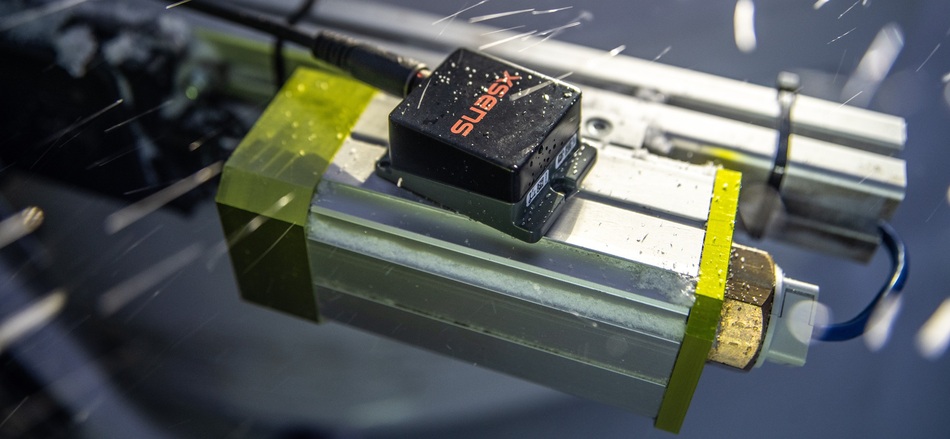
Sirius ships in a small aluminum housing (56.5 × 40.9 × 36.75 mm, 103 g), rated IP68 and tested to MIL-STD-202 for shock, vibration, and environmental stress. Operating range spans -40 °C to 85 °C, and mounting orientation is unrestricted (full 360° in all axes), which simplifies integration into tight or awkward enclosures.
On the connectivity side, both modules offer CAN, CAN-FD, RS232, and RS422, with protocol support for Xbus, ASCII/NMEA, and CAN/CAN-FD. Sync options (SyncIn, SyncOut, ClockSync) support multi-sensor time alignment, and power draw is under 1 W from a 4.5 to 24 V input, a wide enough range to sit comfortably on most vehicle and robotics power buses.
Software support is shared across the family: MT Manager and Firmware Updater for configuration, a Magnetic Field Mapper utility, and an SDK covering C++, C#, Python, MATLAB, and public source code, plus drivers for LabVIEW, ROS, and GO.
Target Applications
The practical decision point for integrators is simple: if the application can tolerate meter-level positioning, Sirius GNSS/INS keeps the system simpler. If the application (survey-grade mapping, precision agriculture, infrastructure inspection, or any task where centimeters matter) needs RTK-grade accuracy, Sirius RTK GNSS/INS delivers that without any change in footprint or integration effort.
Further data on the specs can be found in the data sheet. If you are interested in the module, we can provide you with the Eval-Kit free of charge on loan. Please contact your SE Account Manager or send us an e-mail to vertrieb@spezial.com.
- Roll/Pitch: 0.2° RMS
- Yaw/Heading: 0.8° RMS
- Heave: under 5 to 6 cm, relevant for marine and offshore platforms riding swell
- Velocity: 0.03 m/s RMS
Underneath, the IMU specs are shared across both variants: a ±300°/s gyroscope with 7°/h in-run bias stability, a ±8 g accelerometer with 15 µg in-run bias stability, and a calibrated magnetometer. Strapdown integration (SDI) is supported, with output rates up to 2 kHz general / 400 Hz SDI, enough bandwidth for tight control loops on vehicles or robotic platforms that can't tolerate latency in their state estimate.
A built-in uncertainty output is worth calling out separately: rather than just reporting a position and orientation, Sirius reports real-time data quality, so downstream autonomy stacks can make informed decisions about how much to trust the current fix, particularly valuable during the kind of signal degradation these modules are designed to survive.
Compact, Rugged, and Interface-Flexible
Sirius ships in a small aluminum housing (56.5 × 40.9 × 36.75 mm, 103 g), rated IP68 and tested to MIL-STD-202 for shock, vibration, and environmental stress. Operating range spans -40 °C to 85 °C, and mounting orientation is unrestricted (full 360° in all axes), which simplifies integration into tight or awkward enclosures.
On the connectivity side, both modules offer CAN, CAN-FD, RS232, and RS422, with protocol support for Xbus, ASCII/NMEA, and CAN/CAN-FD. Sync options (SyncIn, SyncOut, ClockSync) support multi-sensor time alignment, and power draw is under 1 W from a 4.5 to 24 V input, a wide enough range to sit comfortably on most vehicle and robotics power buses.
Software support is shared across the family: MT Manager and Firmware Updater for configuration, a Magnetic Field Mapper utility, and an SDK covering C++, C#, Python, MATLAB, and public source code, plus drivers for LabVIEW, ROS, and GO.
Target Applications
- autonomous ground vehicles
- robotics and industrial automation
- marine surface and subsea vehicles (USV/ROV/AUV)
- offshore heave compensation
- surveying and mapping
- AgTech
- infrastructure inspection
- aerospace/defense platforms
The practical decision point for integrators is simple: if the application can tolerate meter-level positioning, Sirius GNSS/INS keeps the system simpler. If the application (survey-grade mapping, precision agriculture, infrastructure inspection, or any task where centimeters matter) needs RTK-grade accuracy, Sirius RTK GNSS/INS delivers that without any change in footprint or integration effort.
Further data on the specs can be found in the data sheet. If you are interested in the module, we can provide you with the Eval-Kit free of charge on loan. Please contact your SE Account Manager or send us an e-mail to vertrieb@spezial.com.